
Search a Carlsbad Street by Address
Start a Carlsbad street directory search with the address as it appears locally. City Planning says directional prefixes have no period, so use S Halagueno rather than S. Halagueno. It also spells numbered streets, such as Eighth St rather than 8th St. Keep the house number and mailing ZIP with the search. Then decide whether the site is in City jurisdiction or in an Eddy County rural-addressing area. City Planning handles City addressing, while County GIS handles rural addressing. That split often explains why one map or form finds an address and another does not.
The useful chain is location first, then parcel clues, then recorded-party history. A tax account or map can help with the legal description. The legal description is the lot, block, subdivision, tract, or survey wording that ties one piece of land to its recorded documents. It is a stronger bridge than a street name alone when a road crosses several subdivisions.
- Normalize the house number, directional prefix, street spelling, and ZIP. Confirm whether City Planning or Eddy County GIS has the relevant addressing role.
- Find the parcel in EagleWeb or the County map and write down the situs address, parcel or account clue, and legal summary.
- Use the owner or legal description in the Clerk’s recorded-document search. Check the candidate record rather than relying on a name match.
- Follow a conveyance backward from grantee to prior grantor, keeping the legal description, document number, book, page, and recorded date together.
- For a past address listing, ask the Public Library for a reverse or criss-cross directory by year and compare it with other dated records.
Each step answers a different question. A deed can establish a recorded party, a parcel card can give tax context, and a historic directory can show a dated listing. They should not be merged into an unsupported claim about present occupancy.
Carlsbad Street Directory Search Terms
Address wording matters in a Carlsbad address search. Try the City’s preferred directional and numbered-street forms first. If a search still fails, retain the house number and try the common spelling variant. For a rural road, begin with the County GIS route instead of assuming a City map controls the address. The Carlsbad Planning and Regulation Department covers City addressing and GIS, while Eddy County GIS handles rural addressing, roads, and address mapping.
Use the map as a geographic aid. It can supply an adjacent parcel, road segment, or subdivision clue. It cannot settle a survey, title, or household question. City map data is reference information rather than survey-quality evidence. A parcel that appears close to a road label still needs a cross-check in the Assessor record and, when ownership history matters, the Clerk record.
- Parcel
- A taxed piece of property identified by an account or parcel number and linked to a map or legal summary.
- Situs address
- The physical location of the property. It is different from the address where a tax bill is sent.
- Plat
- A recorded map that can show lots, blocks, and subdivision layout. It helps connect an address to a legal description.
- Criss-cross directory
- A reverse directory that begins with an address and may list a named householder or business for its publication year.
Note: A mailing ZIP and a street label help search, but neither one alone establishes City jurisdiction, a legal boundary, or a resident list.
Carlsbad Street Maps and Boundaries
A street can be a City address in one context and an Eddy County rural-addressing question in another. Check City Planning for City address and map context, then use County GIS when a road, parcel, or rural location falls outside that scope. The Carlsbad Community Information Map can show the City boundary, planning jurisdiction, wards, zoning, flood zone, parcels, and reference layers.
The County map and City map are useful for placing the street before a record search. Neither map is survey-quality proof of a boundary, and neither establishes title or a household. Preserve the parcel or legal-description clue from the map, then compare it with EagleWeb and the Clerk record.
Browse Carlsbad Streets in EagleWeb
Eddy County EagleWeb is the Assessor’s property-tax and estimated-tax route. Its public form permits a genuine by-street search. Enter the Street Name, select a directional and street designation when known, leave House Number blank, and use City/Zip to narrow results. Review parcels one at a time. EagleWeb requires JavaScript and cookies, and its taxable values are assessment information rather than a current market-value statement.
The form searches all account types by default. Clearing that choice exposes Centrally Assessed, Mobile, Personal Property, and Real Property account categories. For a street parcel, Real Property is usually the relevant category, but the returned account prefix is still worth noting: R identifies real property, M mobile property, P business personal property, and C centrally assessed property.
| Carlsbad field | Input | How to use it | Local format |
|---|---|---|---|
| Street Name | Text | Browse a street when House Number is omitted | Pair with direction or designation when known |
| House Number | Text | Limit the search to one situs address | Optional for a whole-street review |
| City/Zip | Combined text | Narrow a street or address result | Use as a location limiter, not as an owner list |
| Owner Name | Text | Check a person or entity after a parcel is found | Instruction: Last Name First Name |
| Subdivision, Lot, Block | Legal-description fields | Carry parcel clues to Clerk research | Subdivision accepts autocomplete tokens |
The full form also accepts account number, parcel number, business name, tract, section, township, and range. Those fields matter in the Pecos River Valley when a rural tract does not fit a compact City-block address.
Read a Carlsbad Parcel Card Carefully
After an address search returns a Carlsbad parcel, keep the card’s two address ideas separate. The situs identifies where the property sits. The owner address is the tax-mailing destination. It can be a post-office box, trustee, estate, manager, or another property. It is not proof that the recipient lives at the situs. The card is useful because it puts the parcel number and legal summary beside the site, making a later deed search more precise.
This Eddy County parcel viewer image shows the public map route used to add parcel context to a Carlsbad street directory search.
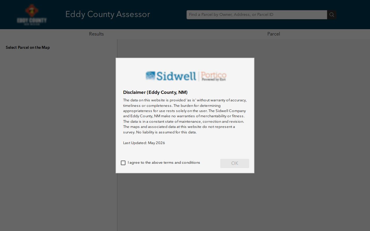
The viewer can search by owner, address, or parcel ID, then show a parcel popup with situs, owner name, owner mailing line, UPC, legal summary, map number, tax area, and other assessment fields. Treat those fields as map and tax context, then verify a recorded interest in the Clerk index.
| Useful parcel-card fields | Account number, situs address, tax area, parcel number, legal summary, map number, parcel size, owner name, and owner address. |
|---|---|
| Tax and map context | Year-labeled value, taxable figures, tax history, and linked assessor-map functions can help identify the record being reviewed. |
| What requires caution | Mailing information is not occupancy evidence, and the displayed value is an assessment attribute rather than a promise of market value. |
Note: Recheck a map or tax-card result in the original record when ownership, boundary, or certified-copy detail matters.
Carlsbad Street Records by Address
A Carlsbad address review gains depth by joining address-keyed sources without asking any one source to do more than it can. The Assessor card gives the current property frame. The County and City maps provide geographic context. The Clerk’s index supplies recorded parties and legal descriptions. Building and Planning files can date activity at an address. A library reverse directory, if held for the needed year, may add a historical listing. The records are complementary, not interchangeable.
| Carlsbad address layer | Custodian | Useful result | Access path |
|---|---|---|---|
| Property-tax account | Eddy County Assessor | Situs, account, legal and tax context | EagleWeb or Assessor counter |
| Parcel and map context | County GIS or City GIS | Roads, parcels, layers, and geographic clues | Public map tools; reference use |
| Deed, plat, lien, or release | Eddy County Clerk | Recorded parties, instrument details, legal description | Official Records Search and Clerk counter |
| Permit or inspection | Carlsbad Building Department | Application, approval, or inspection timing | Permit route or focused request |
| Code or planning file | Carlsbad Planning | City activity and land-use context | Department or targeted IPRA request |
| Historic address listing | Carlsbad Public Library | Dated reverse-directory lead, if held | Catalog and staff confirmation |
The Treasurer can answer tax-payment or delinquency questions, but tax administration does not create a complete occupancy record. The same caution applies to a permit applicant, contractor, agent, or complainant. Those names can be relevant to an activity file without identifying the person who lived at the address.
Trace Carlsbad Street Deed Records
The Eddy County Official Records Advanced Search is party and legal-description based. It does not promise a street-address field. Start with the current parcel’s owner, subdivision, lot, block, tract, or legal description. Search the owner as a grantee or party, inspect the likely conveyance, then use the prior grantor as the next grantee while preserving the same legal-description thread. Record the instrument number, recorded date, book and page when shown, and the parties before moving to the next link.
The advanced-search screen is the source for the fields used in this Carlsbad street directory step.
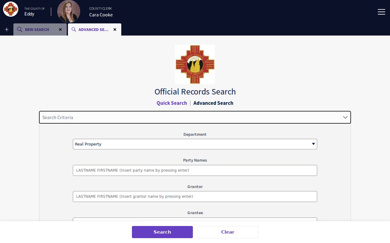
Real Property, Index Books, Marriage, Meeting Minutes, and Probates are separate departments. The visible property controls include Party Names, Grantor, Grantee, recorded-date range, book, page, document types, document number, document-image phrase, and legal description. The historic General Index blocks run from 1884 through 1912, followed by listed Grantor and Grantee blocks from 1912 through 1979. These are index-book ranges, not a guarantee that every deed image is online.
For an early record, contact the Clerk about the underlying book, image, or certified-copy route. The Clerk is at 325 S. Main Street in Carlsbad and directs recording to that office. Its online index is an aid rather than the underlying document, so spelling variants and the record image or counter check remain important.
Carlsbad Street Index Search Tips
The Clerk’s quick search has a useful local distinction. In Index Only mode, two or more words are searched individually. In Index & Full Text (OCR) mode, the same multiword entry is searched as a phrase in document contents. Use OCR as a supplement for an unusual subdivision, street, or legal-description phrase. Then return to the indexed party fields and the record image to confirm what the match actually means.
The quick screen also offers a Real Property department, a search-term field, recorded-date range, common date windows, Search, and Reset. Advanced Search adds Party Names, Grantor, Grantee, book/page, document-number, image phrase, and legal-description choices. The Clerk says recorded-document listings are current through 6 p.m. on the preceding day, but the portal does not publish an online start year, image fee, or universal image availability. Ask the Clerk for those record-specific details rather than guessing.
Eddy County Property Alert is another optional records tool. It can watch new real-property filings for a name or keyword match. An alert is useful for monitoring a term, but it does not guarantee fraud detection or establish a complete street record.
The Property Alert page is shown here because it is a separate recorded-document feature, not a replacement for a full address search.
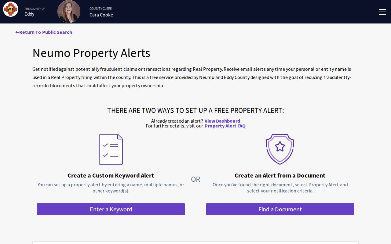
Use a saved alert as a prompt to check a new filing in the Clerk index. Confirm the document type, property description, and parties before drawing any conclusion from a notification.
Note: An alert identifies a possible filing to inspect; it does not settle ownership, document meaning, or the completeness of a record search.
Carlsbad Street Permit and Code Files
Carlsbad Building Department records can add dates to a street history. The Department’s process is application, plan review, approval and fees, then inspections for building, mechanical, plumbing, and electrical work. City Planning and Code Enforcement add zoning, subdivision, annexation, floodplain, and potential code-case context. These sources can show work or municipal activity at a location. They do not reliably identify a household.
This Carlsbad Building Department page leads to the permit route and explains the City process.
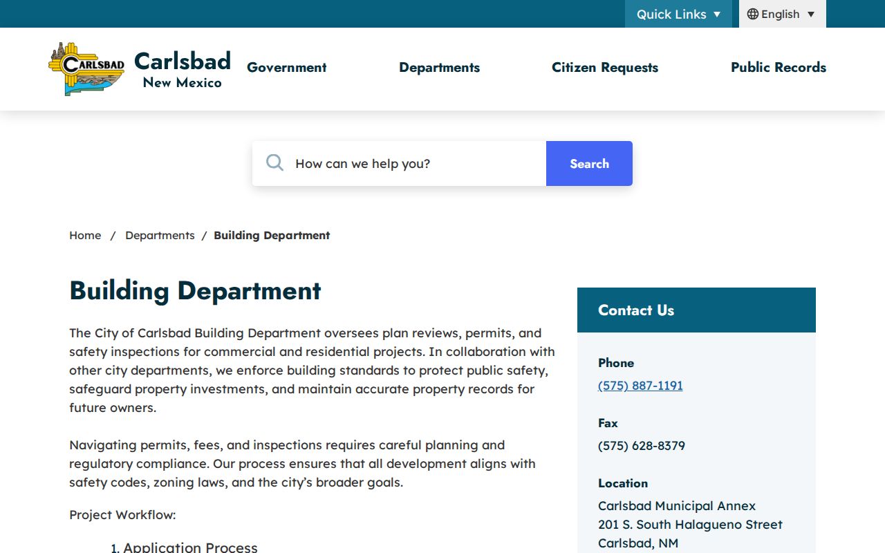
There is no verified public owner or address search-field inventory for the permit portal. When a specific record is needed, request permits, applications, inspection logs, certificates, or code-case closure records by street address and a clear date range. The City may withhold or redact protected information. A contractor, applicant, or complainant should never be treated as the occupant of the property.
For a historical address listing rather than activity files, the Carlsbad Public Library is the safer next stop. Its catalog and staff can confirm whether a reverse or criss-cross directory is available for the precise year. The historical volumes are treated in more detail on the Carlsbad city directory page.
What Carlsbad Street Records Keep Private
A Carlsbad street directory cannot provide a complete list of people at each home. NMVote serves a voter’s own registration and election information, while its address-and-ZIP tool finds a voting location. It is not a public by-street voter directory. A paid signed SERVIS request is a different state process with statutory exclusions and use limits. Court Case Lookup protects address information, and motor-vehicle records are restricted. Utility and delivery information are not a general public directory.
New Mexico Safe at Home also protects eligible participants’ actual residence, delivery address, phone, and email through a substitute-address program. If an address is absent or redacted, respect that boundary. Do not combine map, deed, or voter details to work around protected information. An address trail is most useful for lawful personal research, property history, family history, and civic questions that stay within the source’s limits.
Lawful use. Use Carlsbad address records for lawful personal research only. Never use a street or parcel trail to stalk, harass, intimidate, or harm another person.
For a voter’s own record or local registration question, the Eddy County Clerk is the election office. The Clerk’s office and the NMVote portal are the appropriate starting points, not a street search.